 |
Hobnail Tom Trail
 (32) (named after 'Hobnail' Tom Edwards) is a long trail into the Scapegoat
Wilderness eventually turning northwest just south of the
continental divide. It follows the North Fork of the Blackfoot
towards its headwaters, then crosses and follows Dobrota
Creek just south of the continental divide. Trail Begins:
In Powell County at the North Fork Blackfoot
Trailhead at the end of road 5550.
Trail Ends: In Lewis and Clark County at the Cabin Creek Trail, (junction with Trail 80)
Directions: Take Hwy 200 6-miles east of Ovando to
junction of North Fork of the Blackfoot Road 5550. Follow
signs and Road 5550 to the trailhead. Non-motorized access.
|
Length: 21-30 miles
Local Maps: Lolo Nat'l Forest Seeley Lake Ranger District
(East Half)
USGS Map1: Coopers Lake
USGS Map2: Lake Mountain
USGS Map3: Olson Peak
Township 16N; Range 11W; Section 22 |
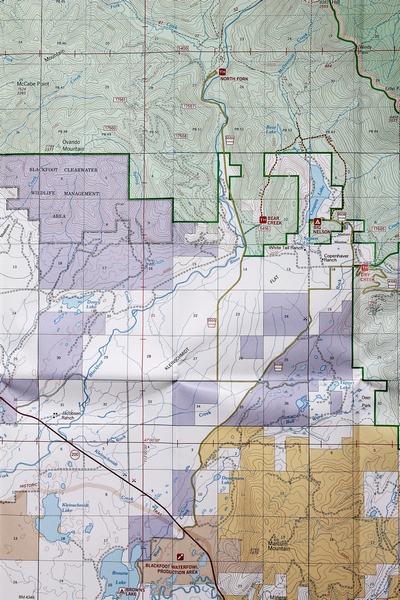
Hobnail Tom Trail (32) begins at the North
Fork Trailhead which
is located in the upper mid-section of the map to the right
→ |
Click on maps to ENLARGE
In the map below, the Hobnail Tom
Trail (32) can be seen just below the word "SCAPEGOAT" runnning southeast to
northwest
where it joins the Cabin Creek Trail (80). |
 |