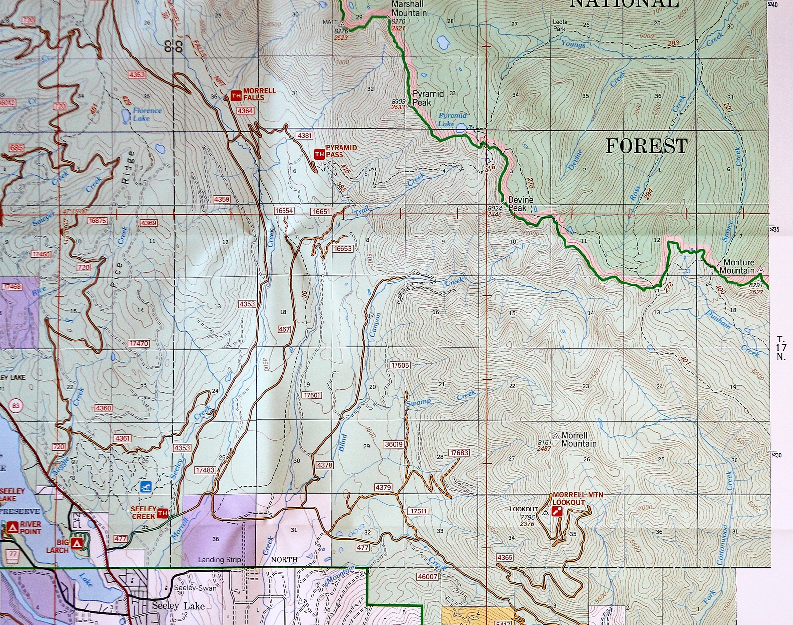
Overview Map - Click map image to ENLARGE
Map of trail system overview for Pyramid
Lake (Southeast of Pyramid Peak) Begin at Pyramid Pass Trailhead
(416)
|
Blackfoot
Divide Trail
|
Blackfoot Divide Trail (278) runs
along the Divide, linking trails from the Seeley Swan Valley
to the Bob Marshall Wilderness.
This is a link trail and it would only be used in
conjunction with trails into or out of the Young's Creek
Drainage in the lower Bob Marshall Wilderness. Closest
road access starts at Cottonwood Lakes Road (477)
which opens May 1st, then turn left at road 4353 heading
north. Turn right at road 4381 to the Pyramid Pass
Trailhead. |
Elevation: 7,290
Length: 5.3 miles
Trail Begins: Pyramid Pass, Junction with Trail 416
Trail Ends: Junction with Trail 40, head of Dunham Creek
Area Map: Lolo Forest Visitors Map
USGS Map1: Crimson Peak
USGS Map2: Morrell Mountain
Township 17N; Range 14W; Section 3
Phone: 406-677-2233
Website:
https://www.fs.fed.us/r1/lolo/
Mailing address: Lolo National Forest, 3583 Highway 83,
Seeley Lake, MT 59868 |
|
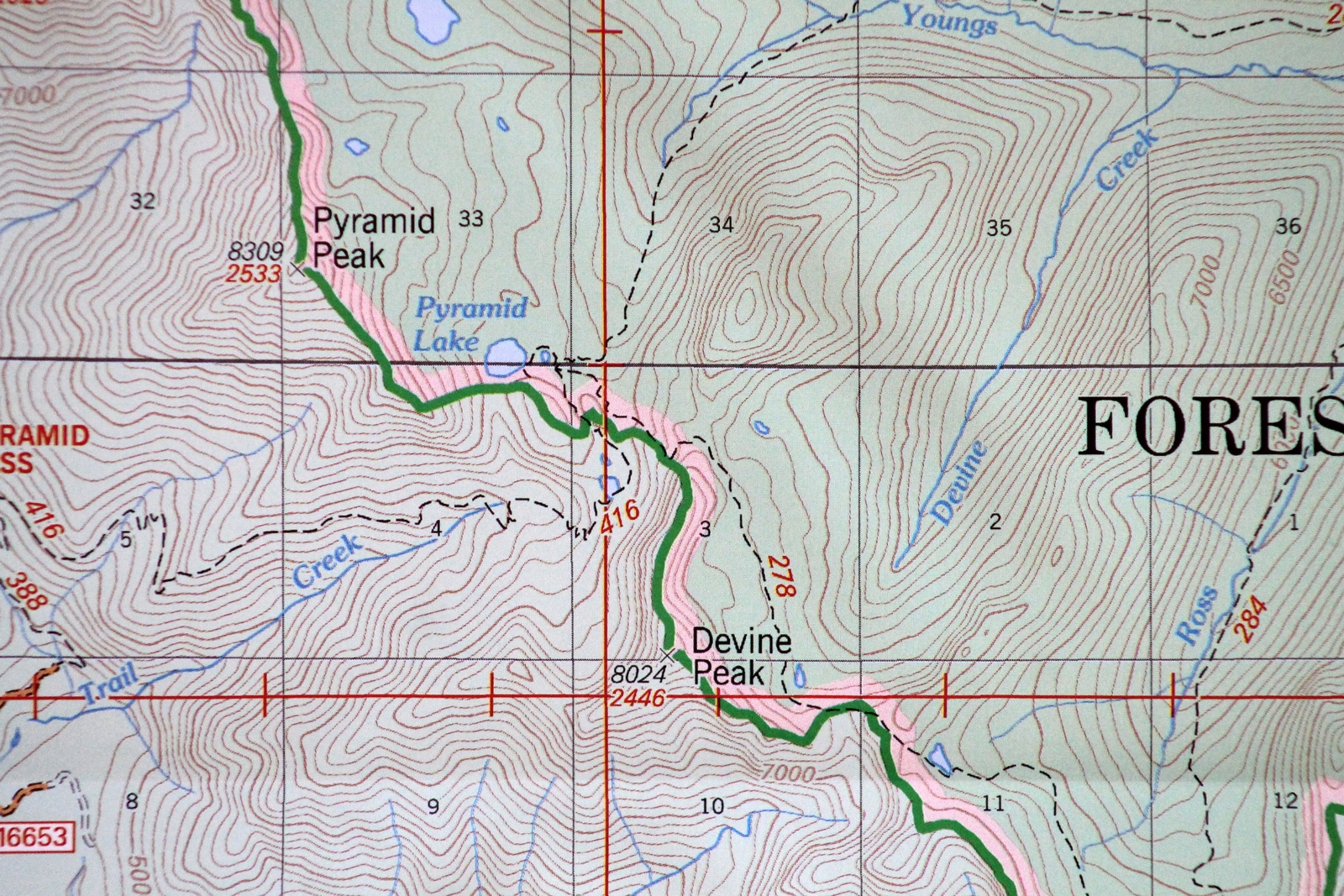
Close-up Map - Click map image to ENLARGE

Close-up map showing location of the
Blackfoot Divide Trail (278) Southeast of Pyramid Lake.
The Pyramid Pass Trail (416) and the Blackfoot Divide Trail
(278) intersect east of Pyramid Lake
|